

Geolocation Meaning: How It Works & Examples
Geolocation is the process of identifying the geographic location of a device, person, object, or digital connection by using technologies such as GPS, Wi-Fi networks, cell towers, IP addresses, Bluetooth signals, and other location data. Smartphones use geolocation every day to provide maps, local weather, ride-hailing services, nearby restaurant suggestions, delivery tracking, and location-based search results. Businesses also use geolocation technology for logistics, fraud prevention, targeted advertising, fleet management, customer experiences, and security. Although people often associate geolocation only with GPS, modern location services usually combine several technologies to determine where a device is located. The accuracy can range from a broad country or city estimate to a highly precise position measured within only a few meters.
The importance of geolocation has increased as mobile devices, connected vehicles, wearable technology, Internet of Things devices, and location-based applications have become part of everyday life. A mapping app may need precise coordinates to provide turn-by-turn directions, while an online retailer may only need an approximate location to display relevant shipping options or local inventory. Different applications therefore require different levels of accuracy, speed, privacy, and battery consumption. Understanding what geolocation means, how location data is collected, and how common positioning technologies differ can help users make better decisions about location permissions. It also helps businesses design useful location-based services without collecting more information than they genuinely need.
What Is Geolocation?
Geolocation means determining the real-world geographic position of a device or internet connection. The result may be expressed as latitude and longitude coordinates, a street address, a city, a postal code, a country, or another geographic reference depending on the technology and intended purpose. Smartphones can use built-in sensors and wireless signals to determine relatively precise positions, while websites may estimate location from an IP address without accessing a phone’s GPS hardware. This difference explains why some online services know your general city but cannot identify your exact street. Geolocation should therefore be understood as a broad category of location determination rather than one single positioning technology.
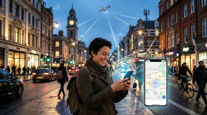
A simple example of geolocation happens when someone opens a map application and selects the option to show their current position. The smartphone gathers location information and estimates where the device is located, then the application displays that position as a point on the map. Several technologies may contribute to the result, including GPS satellites, Wi-Fi networks, cellular signals, and device sensors. The phone may use whichever combination provides the best balance between accuracy, speed, and power consumption. Users see only a location marker, but multiple calculations can occur in the background before that marker appears accurately on the screen.
Geolocation is also widely used without showing users a visible map. A food delivery application may use location data to determine which restaurants can deliver to a customer’s address, while an online marketplace can show products available in a particular region. Banking systems may compare login locations with previous activity to help detect suspicious access attempts. Weather applications use geolocation to automatically provide forecasts relevant to the user’s current area. These examples demonstrate that location technology is often used as contextual information that helps a digital service determine what content, options, security checks, or services should be presented.
The term can apply to people, devices, vehicles, assets, and internet connections depending on context. Fleet operators may track delivery trucks through GPS devices, while logistics companies can monitor containers or equipment using specialized location sensors. Websites can estimate visitor countries through IP geolocation, and smart home devices may use location information to trigger automated actions when residents arrive or leave. In each case, geolocation connects digital information with a physical place. The level of precision varies considerably, so organizations should understand whether their application needs an approximate region, a precise coordinate, or simply confirmation that a device is inside a particular geographic area.
Geolocation is different from a location that a person manually enters into an application. If someone types “Chicago” into a weather website, the site can display Chicago weather without detecting the user’s actual position. True geolocation generally involves deriving a geographic location from technical information associated with a device, connection, sensor, or network. Manual addresses can still be combined with geolocation services, such as converting a typed street address into coordinates for navigation. This conversion process is commonly called geocoding, which is related to geolocation but performs a different task. Understanding these distinctions becomes useful when comparing mapping, navigation, address verification, and location-based software.
How Does Geolocation Work?
Geolocation works by collecting signals or network information associated with a device and converting that information into a geographic estimate. The exact process depends on which positioning technology is available and how precise the result needs to be. A smartphone outdoors may rely heavily on satellite-based GPS, while the same phone inside a large building may combine nearby Wi-Fi networks, cellular information, Bluetooth beacons, and motion sensors. An ordinary website may use only the visitor’s IP address unless the person grants browser permission for more precise device location. Modern systems often combine multiple sources because no single method performs perfectly in every environment.
Satellite positioning works by measuring signals transmitted from navigation satellites orbiting Earth. A receiver inside a phone, vehicle, watch, or dedicated GPS device calculates its position based on timing information from multiple satellites. Accurate positioning generally requires signals from several satellites because the device must solve for its position in three-dimensional space while accounting for time differences. Open outdoor environments usually provide better reception because buildings, roofs, mountains, and other obstacles can weaken or reflect satellite signals. This is why GPS accuracy can decline indoors or in dense urban environments surrounded by tall structures even when the device itself is functioning normally.
Wi-Fi positioning uses information about nearby wireless access points to help estimate location. Large location databases can associate Wi-Fi network identifiers with known geographic positions, allowing a device to compare nearby signals and infer where it is located. This method can work especially well in cities where many wireless networks are available and may provide faster results than waiting for satellite positioning alone. Wi-Fi location can also help inside buildings where GPS signals are weak or unavailable. The technique does not necessarily require connecting to every nearby network because the device can often detect broadcast information and compare it with previously mapped wireless infrastructure.
Cellular positioning estimates location using information from mobile network infrastructure. A phone continuously communicates with cellular towers to maintain service, and the network or device can use information about those towers to estimate geographic position. Accuracy depends on tower density, signal conditions, network technology, and the method being used. Urban areas with many cell sites may provide more detailed estimates than remote regions where towers are separated by much greater distances. Cellular positioning is often combined with GPS and Wi-Fi information so smartphones can obtain a useful location quickly while waiting for more precise satellite data or when some location sources are unavailable.
Software then converts these raw signals into information that applications can use. The operating system may provide a location service that combines several technologies and returns coordinates along with an estimate of accuracy. An application can request location information through approved system interfaces rather than communicating directly with every satellite, Wi-Fi network, or cellular component itself. Modern operating systems also apply user permissions so applications cannot automatically access precise location whenever they want. This software layer makes geolocation easier for developers while giving users greater control over which applications can access location data and whether that access continues in the background.
Main Types of Geolocation Technology
GPS is one of the most widely recognized forms of geolocation technology because it can provide relatively precise outdoor positioning on compatible devices. GPS belongs to the broader category of Global Navigation Satellite Systems, or GNSS, which also includes other satellite navigation constellations used around the world. Modern smartphones may receive signals from multiple compatible satellite systems to improve reliability and positioning performance. Satellite navigation is especially useful for driving directions, outdoor fitness tracking, aviation, shipping, surveying, and other activities where accurate geographic coordinates matter. The main disadvantages are reduced indoor performance, potential signal interference, and increased battery consumption when precise continuous tracking is required.
IP geolocation uses the Internet Protocol address associated with an online connection to estimate geographic location. Services maintain databases that associate blocks of IP addresses with countries, regions, cities, network providers, or organizations. This approach does not require GPS hardware and is therefore useful for websites, cybersecurity systems, content localization, fraud detection, and analytics. However, IP geolocation is usually less precise than device-based positioning and should not be treated as an exact physical address. VPNs, corporate networks, mobile carriers, satellite connections, and internet routing can also make an IP address appear to originate from a location different from where the user is physically located.
Wi-Fi geolocation uses surrounding wireless access points as geographic references. Because Wi-Fi networks are common in offices, homes, stores, transportation hubs, and cities, they can provide useful positioning information when GPS signals are limited. Smartphones and other devices may compare detected network identifiers and signal patterns with known location databases to estimate a position. This process can happen quickly and often requires less power than maintaining continuous satellite positioning. Wi-Fi positioning is particularly valuable in dense urban environments, although the accuracy can change when routers are moved, replaced, or mapped incorrectly within a location database.
Cell tower positioning uses mobile network infrastructure to estimate where a device is located. A basic estimate may rely on the location of the tower serving the device, while more advanced approaches can combine information from multiple towers and signal measurements. This method generally provides broader location information than strong GPS positioning, but it can work when satellite signals are unavailable and Wi-Fi networks are limited. Emergency services, mobile networks, and location platforms can use cellular information as part of a broader positioning solution. The method is particularly useful as a supporting technology because smartphones are already communicating with the cellular network during ordinary mobile operation.
Bluetooth beacons and ultra-wideband technologies provide more specialized forms of short-range positioning. Retail stores, airports, hospitals, museums, warehouses, and industrial facilities can install beacons at known locations so compatible devices can estimate proximity or indoor position. Ultra-wideband can provide very accurate short-distance ranging between supported devices, making it useful for asset tracking and precise device-finding features. These technologies are particularly valuable where outdoor satellite navigation performs poorly or where organizations need room-level or object-level location information. Indoor positioning is therefore becoming an increasingly important part of geolocation as businesses connect physical spaces with digital navigation, automation, and asset-management systems.
Common Geolocation Examples in Everyday Life
Navigation applications provide perhaps the clearest everyday example of geolocation. When users request directions, the application identifies their current location and compares it with the destination to calculate an appropriate route. As the device moves, updated location information allows the map to follow progress, estimate arrival time, and provide instructions before upcoming turns. Traffic information can also be combined with location data so routes change when congestion or road closures occur. Without reliable geolocation, turn-by-turn navigation would require users to continuously tell the application where they were located, making modern driving and walking directions far less convenient.
Ride-hailing and delivery platforms also depend heavily on location services. A ride-hailing application uses the passenger’s location to show nearby drivers and determine an appropriate pickup point, while the driver’s location helps the customer see how long arrival may take. Food and grocery delivery applications use location information to determine whether an address is inside a service area and to track deliveries after an order leaves the store. Couriers can receive routing assistance while customers receive estimated arrival information. Geolocation therefore connects customers, workers, businesses, and routes within one continuously updated system rather than simply placing one device on a map.
Social and communication applications sometimes use geolocation to help people share places or discover nearby content. Users may attach a location to a photograph, check in at a restaurant, share their live position with trusted contacts, or search for businesses close to their current location. Dating and social discovery apps may use approximate proximity to help users find relevant profiles or events nearby. Because these features can reveal sensitive personal information, applications should provide clear controls over whether location is shared publicly, privately, temporarily, or not at all. Users should also understand that a location attached to content may remain visible long after they have physically left that place.
Retail and marketing provide another common category of geolocation examples. A retailer may detect a visitor’s approximate region to display local store availability, appropriate pricing, shipping information, or regional promotions. Mobile applications can use permission-based location services to help customers find the nearest branch or receive offers relevant to nearby locations. Businesses may also analyze aggregated location patterns to understand where customers travel from, although privacy and consent requirements should be considered carefully. Effective location-based marketing provides useful context rather than sending constant notifications simply because a person happens to walk near a commercial location.
Emergency, transportation, and safety applications can use geolocation in ways that go beyond convenience. Connected vehicles can share positioning information for roadside assistance, fleet operators can locate vehicles during breakdowns, and certain devices can help users send their position during emergency situations. Family location-sharing tools may help household members coordinate travel or confirm that someone has arrived safely when used with informed consent. Emergency location technology can also assist responders in identifying where help may be needed, although capabilities vary by device, network, region, and emergency system. These examples show why location accuracy and reliability can sometimes have consequences far more important than advertising or navigation convenience.
Geolocation vs GPS, Geofencing, and Geocoding
Geolocation and GPS are often treated as interchangeable terms, but GPS is only one technology that can be used to determine geolocation. Geolocation is the broader concept of identifying where a device, person, or connection is located, while GPS specifically relies on signals from the Global Positioning System satellite constellation. A smartphone may display an accurate location even when GPS reception is weak because Wi-Fi and cellular information can contribute to the estimate. A website may also determine a visitor’s general location from an IP address without using GPS at all. Thinking of GPS as one tool inside the broader geolocation category makes the relationship easier to understand.
Geofencing is another related concept, but its purpose is to determine whether a device enters, leaves, or remains inside a predefined geographic boundary. A business might create a virtual boundary around a store, warehouse, worksite, or neighborhood and trigger an action when an authorized device crosses that area. A smart home application could switch certain settings when a resident approaches home, while a logistics platform might record when a delivery vehicle reaches a distribution center. Geofencing therefore depends on location information but focuses on geographic rules and events rather than simply calculating coordinates. The boundary can vary greatly in size depending on the application and available positioning accuracy.
Geocoding converts a human-readable location such as a street address into geographic coordinates that mapping systems can use. If someone enters a restaurant address into a navigation app, the service may geocode that address into latitude and longitude before calculating the route. Reverse geocoding performs the opposite operation by translating coordinates into an address or recognizable place name. These processes are essential because people usually think in terms of streets, buildings, businesses, and landmarks rather than raw geographic coordinates. Geocoding therefore connects human-friendly location descriptions with the coordinate-based systems that maps, navigation tools, and geographic information platforms use internally.
Location tracking is another phrase commonly associated with geolocation, but it typically involves collecting location repeatedly over time. One geolocation reading might show that a delivery truck is at a warehouse at 10:00 a.m., while tracking would record how the truck’s position changes throughout the route. Fitness applications can similarly track runners or cyclists to calculate distance and display completed routes. Continuous tracking can create valuable functionality but also increases privacy and battery considerations because the system may collect much more information than a single location request. Applications should therefore request ongoing access only when continuous positioning genuinely supports an expected feature.
Geographic Information Systems, commonly called GIS, use geographic data for deeper mapping, visualization, analysis, and decision-making. Geolocation can provide the current position of a device, while GIS can combine that location with layers showing roads, land ownership, population, weather, infrastructure, environmental conditions, or other spatial information. Governments, utilities, transportation planners, researchers, retailers, and emergency-management organizations use GIS for complex geographic analysis. The two concepts therefore complement one another but are not identical. Geolocation answers the question “where is this?” while GIS can help answer broader questions about what surrounds that location, how geographic patterns relate, and how spatial information should influence planning.
Benefits of Geolocation for Businesses and Users
Convenience is one of the strongest benefits because geolocation allows digital services to understand physical context without requiring users to repeatedly enter their location manually. Navigation apps can begin routes from the current position, weather applications can automatically display local forecasts, and search platforms can prioritize nearby businesses. This reduces friction and makes mobile applications feel more responsive to what a person is doing in the real world. The value is particularly obvious when someone is traveling and does not know the local street names or postal codes. Useful geolocation removes unnecessary steps while still allowing users to correct or manually enter locations when automatic detection is inaccurate.
Businesses use geolocation to improve logistics and operational visibility. Delivery companies can monitor vehicle progress, estimate arrival times, optimize routes, and respond more quickly when delays occur. Field service organizations can assign nearby technicians to urgent jobs, while construction or equipment companies can track authorized assets across large worksites. Location information can also support inventory movement between warehouses and stores when integrated with broader logistics systems. These capabilities can reduce wasted travel and improve customer communication, although businesses should limit location collection to legitimate operational needs. Tracking employees continuously without a clear reason can create unnecessary privacy concerns even when the technology itself makes such monitoring possible.
Security and fraud prevention provide another benefit because geographic context can help organizations identify unusual activity. A banking system might notice that an account normally accessed from one country suddenly receives a login attempt from a distant region, prompting additional authentication. E-commerce companies can compare billing, delivery, device, and network locations when evaluating potentially fraudulent transactions. Geolocation should not be used as the only security signal because VPNs, travel, mobile networks, and inaccurate databases can create legitimate location differences. When combined with device information, account history, authentication, and behavioral analysis, however, geographic context can strengthen risk-based security systems.
Location-based personalization can improve digital experiences when used carefully. Travel applications can recommend nearby attractions, retailers can show the nearest branch, and event platforms can prioritize activities taking place within a reasonable distance. News and weather services can surface regional information, while streaming and media platforms may use geographic information to comply with licensing requirements. The most useful personalization is transparent and connected clearly to user intent. Excessive targeting or unexpected location-based notifications can feel intrusive, so businesses should avoid assuming that technical access to location automatically means customers want every experience personalized around where they are.
Geolocation data can also support planning and analysis when information is properly aggregated and protected. Retail businesses may analyze geographic demand to determine where future stores or delivery zones could make sense, while transportation organizations can study travel patterns to improve routes. Public agencies can use geographic information to plan infrastructure, respond to emergencies, and understand service coverage. Researchers can analyze spatial patterns in environmental, economic, or social data when appropriate safeguards are in place. These use cases show that geolocation provides value beyond tracking individual devices; location information can reveal patterns that help organizations understand how activities, resources, and services are distributed across physical space.
Geolocation Privacy and Security Considerations
Location data can be highly sensitive because repeated geographic information can reveal where someone lives, works, travels, shops, or spends significant time. A single broad city estimate may reveal relatively little, while months of precise location history can provide a detailed picture of personal routines. For this reason, applications should collect location information only when it supports a clear feature or legitimate business need. Users should also review location permissions periodically because an application that needed access during initial use may no longer require it later. Treating location as sensitive information encourages both developers and users to think carefully before allowing continuous collection.
Modern mobile operating systems provide permission controls that allow users to choose how applications access location. Depending on the platform and application, users may be able to allow access only while the app is in use, grant one-time access, provide an approximate rather than precise location, or deny access completely. Background location deserves special attention because it can allow an application to collect geographic information even when the user is not actively looking at it. Some legitimate services, such as navigation or location-sharing tools, may require this capability, but many ordinary applications do not. Choosing the least permissive option that still supports the desired feature can reduce unnecessary collection.
Businesses collecting geolocation data should also establish retention and access controls. Information should not remain stored indefinitely simply because storage is inexpensive, particularly when older location history no longer contributes to the original business purpose. Access should be limited to employees and systems that genuinely need the information, and sensitive datasets should receive appropriate technical protections. Organizations should also understand whether third-party analytics, advertising, mapping, or software providers receive location information through their applications. Privacy risk can increase when data passes through multiple vendors, making clear contracts, data inventories, and governance important parts of responsible geolocation deployment.
Location spoofing presents a different kind of security challenge because geographic information can sometimes be manipulated. VPN services can change the apparent IP-based location of an internet connection, while specialized techniques can falsify GPS or other positioning information under certain circumstances. Applications that use geolocation for high-risk security decisions should therefore avoid assuming location data is impossible to fake. Fraud prevention systems can combine geography with device identity, authentication history, behavioral patterns, and other signals. Location should generally be treated as one piece of contextual evidence rather than absolute proof that a particular person or device is physically present in a location.
Users can improve privacy by reviewing app permissions, disabling unnecessary background location access, and understanding which sharing features are active. Live location links should be shared only with people who genuinely need them, and social posts should be checked before publishing precise locations publicly. Parents and organizations should also discuss location tracking openly rather than using monitoring secretly when consent and expectations can reasonably be established. Geolocation is not inherently unsafe, and many valuable services would become less useful without it. The goal is to match the amount of location access with the actual benefit being provided, reducing unnecessary exposure while preserving useful functionality.
Geolocation Accuracy, Limitations, and Best Practices
Geolocation accuracy varies because each positioning method has different strengths and limitations. GPS can be very accurate outdoors but may perform poorly under roofs or between tall buildings, while Wi-Fi positioning can work well in cities but depends on available and correctly mapped access points. IP geolocation may determine a country or city reasonably well but usually cannot identify an exact household. Cellular positioning can provide useful estimates where other sources are unavailable, although accuracy can decrease in areas with sparse tower coverage. Applications should therefore select a method based on the precision their feature actually requires rather than demanding maximum accuracy for every location request.
Environmental conditions can also affect results. Mountains, dense buildings, tunnels, underground facilities, weather-related conditions, radio interference, or weak network connectivity can reduce the quality or availability of location signals. Indoor environments present particular challenges because satellite signals may not penetrate structures reliably, which is why Wi-Fi, Bluetooth, ultra-wideband, and indoor mapping technologies are increasingly important. Users should not automatically assume their device is malfunctioning when a location marker temporarily shifts in a difficult environment. Positioning systems usually provide accuracy estimates, and well-designed applications can use those estimates to avoid presenting an uncertain location as perfectly precise.
Battery consumption is another limitation, especially when applications request high-accuracy location continuously. Satellite positioning, frequent network scans, and constant background updates can increase energy use compared with occasional approximate location checks. Mobile operating systems attempt to balance performance and battery life by combining sensors and using lower-power techniques when precise tracking is unnecessary. Developers can help by requesting location only as frequently and accurately as their features require. A weather application may need a broad location only occasionally, while turn-by-turn navigation reasonably requires continuous updates. Matching technical intensity to actual use is both a performance and user-experience best practice.
Businesses should also design fallbacks for situations in which geolocation fails or users decline permission. A retail website can allow customers to enter a postal code manually, while a weather application can let users search for a city instead of requiring device location. Delivery services can allow customers to adjust a map pin when automated positioning identifies the wrong entrance or building. These alternatives improve accessibility and reduce the risk of making an otherwise useful service unusable simply because one positioning technology is unavailable. Location should enhance the experience rather than become an unnecessary barrier when users can provide the required geographic information through another method.
The best geolocation implementations combine technical accuracy with transparency, privacy, and practical design. Applications should explain why location is needed before requesting permission, collect only the level of precision required, avoid unnecessary background tracking, and provide meaningful alternatives where possible. Organizations should secure stored location information and remove it when retention no longer serves a valid purpose. Developers should also test location features across rural areas, cities, indoor environments, slow networks, and devices with different positioning capabilities. Geolocation creates the most value when users understand the benefit and remain in control, while the technology quietly provides accurate context without collecting more information than necessary.
Frequently Asked Questions
What does geolocation mean?
Geolocation means determining the geographic position of a device, person, object, or internet connection using information such as GPS signals, Wi-Fi networks, cell towers, IP addresses, or other positioning technologies. The resulting location can range from a broad country estimate to precise latitude and longitude coordinates.
Is geolocation the same as GPS?
No. GPS is one method used for geolocation, while geolocation is the broader concept of determining a location through GPS, Wi-Fi, cellular networks, IP addresses, Bluetooth, or other technologies. A device can therefore determine geolocation even when GPS is unavailable.
What is an example of geolocation?
A common example is a navigation app detecting your current position and providing directions to a destination. Other examples include ride-hailing apps finding nearby drivers, weather apps showing local forecasts, and delivery services tracking an order’s location.
Can websites detect my exact location?
Websites can often estimate a general location from an IP address, but this usually does not reveal an exact physical address. More precise browser-based location typically requires permission and may use location services available on the device.
Is geolocation safe?
Geolocation can be used safely when applications collect only necessary information, protect stored data, and give users meaningful permission controls. Because precise location can reveal sensitive personal routines, users should limit access to trusted applications and avoid unnecessary continuous location sharing.