
Spatial Computing: How It Works & Why It Matters
Spatial computing is a form of computing that allows digital information to understand, appear within, and respond to the three-dimensional physical world around us. Instead of interacting only with flat screens, keyboards, or touch interfaces, people can work with digital objects that seem positioned on tables, walls, factory floors, buildings, or entire landscapes. Technologies such as augmented reality, mixed reality, virtual reality, computer vision, artificial intelligence, depth sensing, and spatial audio all contribute to these experiences. Headsets and smart glasses are common examples, but spatial computing can also involve smartphones, robots, cameras, vehicles, and industrial systems. The central idea is that computers become aware of physical space rather than treating every interaction as a flat digital surface.
Spatial computing has gained greater attention as hardware becomes lighter, sensors become more accurate, and artificial intelligence becomes better at understanding real-world environments. Modern systems can track hands and eyes, identify objects, measure depth, map rooms, remember where digital content was placed, and respond naturally to voice or movement. Businesses are also connecting spatial computing with digital twins, robotics, remote collaboration, training, and 3D design. Consumer platforms increasingly allow apps, videos, games, and productivity tools to exist as persistent objects inside physical spaces. These developments suggest that spatial computing is becoming more than a specialized gaming technology. It represents a broader change in how humans may interact with computers, data, machines, and digital content.
What Is Spatial Computing?
Spatial computing describes technology that enables computers to understand physical environments and position digital information meaningfully within those environments. A traditional computer knows where an icon is located on a two-dimensional screen, but a spatial computer can potentially understand that a desk is in front of you, a wall is several feet away, and your hand is reaching toward a virtual object. It combines information about location, depth, movement, orientation, and surrounding objects to create context-aware experiences. Digital content can therefore behave as if it shares the same physical space as the user. This makes computing feel less separated from the surrounding environment and more integrated with how people naturally see and move through the world.
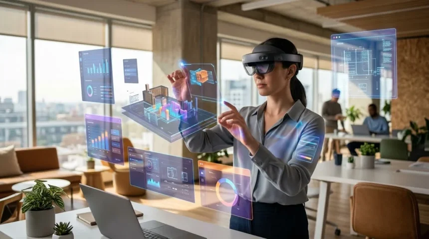
A simple spatial computing example is placing a virtual television on a real wall while wearing a mixed reality headset. The system must first detect the wall, estimate its size and position, track the movement of your head, and continually render the virtual screen from the correct perspective. If you walk around the room, the television should appear to remain attached to the same wall instead of moving with your eyes. Similar technology can place virtual furniture inside a room, display instructions beside a machine, or show a three-dimensional medical model in front of a student. These experiences require far more environmental awareness than simply showing graphics on a conventional screen.
The term spatial computing is closely related to extended reality, commonly shortened to XR, but it usually describes a broader computing concept. XR is an umbrella term that includes augmented reality, virtual reality, and mixed reality experiences. Spatial computing includes those technologies while also emphasizing environmental understanding, natural interaction, persistent digital objects, spatial mapping, and computer awareness of real-world geometry. A robot navigating a warehouse, for example, relies heavily on spatial computing even though no person is wearing an XR headset. Similarly, an autonomous system using cameras and depth sensors to understand its surroundings operates spatially. The concept therefore extends beyond immersive displays and includes machines that perceive, model, and interact with physical environments.
Spatial computing also changes how software interfaces can be designed. Traditional applications are usually organized inside rectangular windows with buttons, menus, and scrolling pages. Spatial applications can still use familiar windows, but developers can also introduce three-dimensional models, surrounding environments, anchored information panels, and objects users can manipulate through movement. A designer might place a life-sized virtual car in a studio, while a medical student could walk around an anatomical model. Productivity applications can position multiple screens throughout a workspace without requiring several physical monitors. The interface becomes part of the surrounding space, giving developers an additional dimension for organizing information and interaction.
By 2026, spatial computing increasingly combines immersive interfaces with artificial intelligence and environmental understanding. New XR platforms are emphasizing object tracking, improved hand and eye tracking, spatially anchored applications, AI assistants, and the ability to transform traditional content into more dimensional experiences. Industrial platforms are simultaneously using spatial computing for digital twins, robotics simulation, factory optimization, and remote monitoring. This convergence is important because it moves spatial computing beyond isolated entertainment applications. The technology is becoming a way for software to understand both digital information and the physical context around it. That combination may ultimately determine why spatial computing becomes valuable across so many different industries.
How Does Spatial Computing Work?
Spatial computing begins with sensors that collect information about the user and surrounding environment. Depending on the device, these may include cameras, accelerometers, gyroscopes, depth sensors, microphones, infrared sensors, GPS receivers, and other specialized hardware. Cameras provide visual information about surfaces and objects, while motion sensors determine how the device moves and rotates. Depth sensing estimates how far objects are from the user, helping software understand the three-dimensional structure of a room. GPS and other location technologies can provide broader geographic context for outdoor experiences. All these signals must be combined rapidly because even small delays can make virtual objects appear unstable or disconnected from the real world.
The next step involves spatial mapping, where software creates a digital representation of the environment around the device. Computer vision algorithms analyze camera images to identify features, edges, surfaces, and movement patterns. Depth information can help determine the shape and distance of real objects such as walls, furniture, floors, or people. The system may gradually build a three-dimensional map while the user moves through the environment. This map becomes a coordinate system where digital content can be positioned consistently. If the system understands where the floor and walls are located, applications can place virtual objects realistically rather than displaying them at arbitrary positions.
Tracking is another essential part of spatial computing because the system needs to understand where the user or device is located within the mapped environment. Technologies related to simultaneous localization and mapping, commonly called SLAM, can estimate position while simultaneously improving the surrounding map. Head tracking makes virtual content respond correctly when someone turns or moves their head. Hand tracking can identify fingers, gestures, and reaching movements, while eye tracking can estimate which object the user is looking toward. Object tracking can follow specific physical items as they move through space. Accurate tracking creates the illusion that digital and physical elements belong to one coherent environment.
Once the environment and user position are understood, the system renders digital content from the correct visual perspective. A virtual chair placed on a real floor should appear larger when approached and smaller when viewed from farther away. Real objects may also need to visually block virtual objects when positioned in front of them, a technique called occlusion. Modern depth systems help applications determine which surface should appear closest to the viewer. Lighting estimation can make virtual objects respond more naturally to illumination in the room. These subtle visual details are important because spatial computing becomes more convincing when digital content behaves according to the same visual rules as physical objects.
Finally, spatial computing systems continually repeat this entire process many times every second. Sensors capture updated information, tracking systems estimate movement, environmental maps are refined, and graphics are rendered again from the user’s latest viewpoint. Artificial intelligence may simultaneously identify objects, interpret voice commands, understand gestures, or generate context-aware responses. High-performance processors and graphics hardware are therefore important because the experience must remain responsive despite considerable computational complexity. Some demanding rendering or simulation work may also be performed on nearby computers or cloud infrastructure and streamed to the device. Spatial computing is ultimately a real-time feedback loop connecting sensors, software, physical space, and human interaction.
Core Technologies Behind Spatial Computing
Computer vision is one of the foundational technologies behind spatial computing because it allows devices to interpret visual information from cameras. Instead of treating an image as a collection of pixels, computer vision systems attempt to understand meaningful features within the scene. They may identify walls, furniture, hands, faces, tools, vehicles, or other objects relevant to an application. Visual feature detection can also help determine how the camera moves by comparing changes across consecutive frames. Modern AI models make scene understanding increasingly sophisticated by recognizing categories and relationships between objects. This visual intelligence provides spatial systems with information needed to interact intelligently with the physical world.
Depth sensing provides another important layer because a normal photograph does not always reveal precise distances between objects. Some spatial devices use dedicated time-of-flight, structured-light, or similar depth technologies, while others estimate depth using multiple cameras or movement-based algorithms. Depth maps assign approximate distance values to different parts of a scene, helping software understand shape and geometry. This allows virtual content to move behind furniture, rest correctly on surfaces, or respond when a person reaches toward it. Outdoor spatial experiences can combine local depth information with geographic and building data. Better depth understanding makes digital objects feel increasingly integrated with real environments rather than simply overlaid on camera footage.
Motion tracking relies on sensors such as accelerometers and gyroscopes to measure movement and rotation. These sensors can respond extremely quickly, which helps maintain visual stability while slower camera-based tracking provides additional correction. Combining several types of sensor information is commonly called sensor fusion. The system compares signals from multiple sources and produces a more reliable estimate than any one sensor could provide independently. Accurate motion tracking is particularly important in head-mounted displays because even slight inconsistencies between head movement and visual response can reduce comfort. Spatial computing therefore depends heavily on precise synchronization between physical motion and digital rendering.
Artificial intelligence is becoming increasingly important because spatial devices need more than geometric measurements to understand complex environments. AI can identify objects, interpret speech, recognize gestures, generate descriptions, and help users interact conversationally with spatial systems. A maintenance application could potentially recognize a machine component and display relevant repair information beside it. Smart glasses may combine cameras with AI assistants that understand what a wearer is looking at and provide useful contextual help. Industrial digital twins can connect AI with live sensor information to analyze physical operations. This movement toward spatial AI allows systems to reason about environments instead of merely displaying three-dimensional graphics.
Spatial audio is another technology that can make immersive environments feel more realistic and informative. Traditional stereo audio primarily places sound between left and right channels, while spatial audio attempts to reproduce how sound would behave from different directions and distances. If a virtual person stands behind the user, their voice can appear to originate from that location. Audio cues can also guide attention toward notifications or events outside the current field of view. Head tracking may adjust the sound field as a user turns, helping audio sources remain positioned in space. Combining realistic sound with visual positioning strengthens the sense that digital content occupies the surrounding physical environment.
Spatial Computing vs. AR, VR, and Mixed Reality
Augmented reality, or AR, adds digital information to a view of the physical world without fully replacing the surrounding environment. A smartphone application that places virtual furniture in a room is a familiar example. The device uses its camera and motion sensors to understand enough of the environment to keep the furniture positioned correctly as the phone moves. Navigation applications can also display directions relative to streets or buildings, while retail apps may preview products before purchase. AR is therefore one important form of spatial computing. However, spatial computing is broader because it includes environmental understanding, persistent content, robotics, digital twins, and other technologies beyond visual overlays.
Virtual reality, or VR, places the user primarily inside a computer-generated environment rather than showing the physical surroundings continuously. A VR headset can transport someone into a game world, training simulator, virtual meeting room, architectural model, or educational environment. Even though the world is virtual, spatial computing still plays a major role because the device must track head and controller movement in three dimensions. Some systems also track hands, eyes, and the user’s physical boundaries. This allows virtual spaces to respond naturally to movement. VR therefore represents the more immersive end of the spatial computing spectrum, where digital environments largely replace visual awareness of the real world.
Mixed reality, or MR, blends physical and digital environments more deeply by allowing virtual objects to interact meaningfully with the surrounding space. A digital ball might bounce off a real table, or an instructional model could remain attached to a physical machine while the user walks around it. Mixed reality devices typically require strong environmental mapping and depth understanding because software needs information about real-world geometry. The experience may use video passthrough cameras or transparent displays depending on the hardware design. Mixed reality is closely associated with modern spatial computing because it demonstrates how digital content can become contextually connected to physical surroundings. The boundary between AR and MR is sometimes flexible in everyday product descriptions.
Extended reality, usually abbreviated XR, provides a convenient umbrella term for augmented reality, mixed reality, and virtual reality technologies. Companies often use XR when discussing devices or software platforms that can support several levels of immersion. A modern headset may display ordinary floating application windows one moment, blend three-dimensional objects with a room the next, and then transition into a fully immersive environment. This ability to move smoothly between modes makes rigid definitions less important from the user’s perspective. Spatial computing focuses more on the underlying relationship between computing and physical space. XR describes the spectrum of immersive experiences, while spatial computing describes the broader computing approach that makes many of them possible.
The differences matter because not every spatial computing application requires a headset. A smartphone performing room measurement uses spatial computing, as does an autonomous robot navigating around warehouse shelves. A digital twin representing a manufacturing facility can use spatial information even when employees view it on conventional monitors. Headsets and glasses make spatial computing particularly visible because they bring interfaces directly into a user’s surroundings, but they are only one category of device. This distinction becomes increasingly important as AI, robotics, automotive systems, cameras, and wearable devices gain stronger environmental awareness. Spatial computing is ultimately about computers understanding and interacting with space, regardless of the display technology used.
Real-World Uses of Spatial Computing
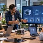
Manufacturing is becoming one of the strongest business use cases for spatial computing because factories contain complex physical systems that benefit from three-dimensional visualization. Engineers can create digital twins representing machines, production lines, warehouses, or entire facilities before expensive physical changes are made. Teams can experiment with equipment layouts, workflow routes, safety procedures, and robotic systems inside simulations. Real-time operational data can also be connected with these digital environments to support monitoring and troubleshooting. Workers wearing spatial devices may eventually receive instructions positioned directly beside equipment requiring attention. These capabilities make spatial computing valuable throughout design, training, production, maintenance, and optimization.
Healthcare uses spatial computing for education, surgical planning, rehabilitation, visualization, and clinical training. Medical students can study three-dimensional anatomical models that can be enlarged, rotated, or explored from different perspectives. Surgeons may use advanced visualization tools to examine patient-specific anatomy before certain complex procedures. Rehabilitation applications can create interactive exercises that respond to a patient’s movement through space. Remote specialists may also collaborate around shared three-dimensional medical information without being physically located in the same room. Spatial tools do not replace professional clinical judgment, but they can provide ways of understanding complex information that are difficult to reproduce with flat images alone.
Education and professional training can benefit because spatial experiences allow people to learn through interaction rather than observation alone. A student studying the solar system could walk around scaled three-dimensional planets, while an engineering trainee could examine the internal structure of a machine without dismantling real equipment. Safety training can simulate dangerous workplace situations without placing learners in actual danger. Aviation, military, emergency response, logistics, and technical industries have long used simulation, but modern spatial devices can make immersive training more accessible. Lessons can also respond to gaze, hand movement, and environmental context. Learning becomes experiential, allowing users to practice actions rather than only reading descriptions or watching videos.
Retail and ecommerce can use spatial computing to help customers understand products before making purchase decisions. Furniture buyers can preview how a sofa might fit inside a real living room, while fashion applications may support increasingly sophisticated virtual try-on experiences. Automobile brands can allow customers to inspect digital vehicles at realistic scale without requiring every configuration to be physically available. Real estate platforms can create immersive property experiences, and home design tools can display renovations before construction begins. These applications reduce the gap between imagining a product and experiencing its size or placement. When implemented accurately, spatial previews can help shoppers make more informed decisions about products that depend heavily on physical context.
Entertainment remains an important area because spatial computing can transform games, movies, sports, and social experiences. Instead of watching everything within a fixed rectangle, users can place enormous virtual screens in their rooms or experience media that surrounds them. Games can use furniture, walls, and floor space as part of interactive environments. Live sports experiences can provide multiple virtual screens or immersive perspectives that conventional television cannot easily reproduce. Social platforms can create shared spatial environments where distant participants feel more present with one another. Entertainment is often where consumers first experience new interface technologies, but many interaction patterns developed for gaming eventually influence productivity, education, design, and other professional applications.
Spatial Computing, AI, and Digital Twins
Artificial intelligence and spatial computing complement each other because spatial systems collect large amounts of information about physical environments while AI helps interpret that information. Cameras may capture objects, surfaces, people, text, and movement, but raw sensor data is only useful when software can understand what it represents. AI models can classify objects, recognize activities, interpret natural language, and identify relevant patterns in spatial information. This makes interfaces more context-aware. Instead of manually searching for instructions, a worker might look at equipment and ask an AI assistant about a visible component. The combination allows computing systems to respond not only to what users say but also to what surrounds them.
Generative AI may also change how spatial content is created. Building detailed three-dimensional environments traditionally requires specialized modeling skills, considerable time, and complex software. AI-assisted tools can increasingly help generate textures, objects, scenes, animations, and depth information from simpler inputs. Some platforms can add dimensional depth to previously flat photographs or transform existing content into more immersive experiences. Developers may eventually describe environments conversationally and allow generative systems to assemble much of the spatial scene automatically. Human designers will still need to evaluate accuracy, usability, and visual quality. However, lower creation barriers could dramatically increase the amount of spatial content available to ordinary users and businesses.
Digital twins are virtual representations of physical objects, facilities, or processes that can be connected with real-world data. A factory digital twin might contain three-dimensional models of machinery alongside information from sensors, maintenance systems, cameras, and production software. Engineers can use the digital environment to understand current operations or test hypothetical changes without disrupting the real facility. Spatial computing makes these digital twins easier to explore because teams can navigate them visually and interact with information in context. AI can then analyze operational patterns or help simulate possible outcomes. This combination is particularly powerful for industries where mistakes in the physical world are expensive, dangerous, or difficult to reverse.
Robotics is another area where spatial computing and AI intersect naturally. Robots need to understand their position, recognize objects, estimate distances, plan paths, and react to moving people or equipment. Spatial simulation allows developers to train and test robotic systems within virtual replicas before deploying them physically. Thousands of scenarios can potentially be simulated without repeatedly rearranging a real factory or warehouse. Synthetic data generated inside these environments can also help train vision systems. When a robot eventually enters the physical world, cameras, depth sensors, and AI models continue providing environmental awareness. Spatial computing therefore supports both the development and real-time operation of increasingly autonomous machines.
On-device AI is also becoming more important in headsets and smart glasses because not every spatial interaction should require a constant cloud connection. Local processors can analyze hand movement, track eyes, recognize objects, and run certain AI models with lower latency. Keeping some processing on the device may also provide privacy advantages because sensitive camera or gaze information does not necessarily need to leave the hardware for every interaction. Cloud computing will still be valuable for large models and demanding simulations, creating hybrid systems that divide workloads intelligently. Faster local AI makes spatial interfaces more responsive. It can also enable wearable devices to understand context continuously without depending entirely on remote infrastructure.
Benefits, Risks, and Challenges of Spatial Computing
One major benefit of spatial computing is that it can make complex information easier to understand by presenting it in three dimensions. Engineers examining machinery, doctors studying anatomy, and architects reviewing buildings often work with inherently spatial problems. Flattening those problems onto a two-dimensional display can remove useful perspective and scale. Spatial visualization allows users to walk around models, compare them with real objects, and understand relationships from natural viewpoints. The technology can also make collaboration more intuitive when several participants examine the same shared model. Better understanding can reduce errors and shorten decision-making processes, particularly in industries where physical geometry strongly influences outcomes.
Spatial computing can also improve productivity by allowing information to appear where it is needed rather than forcing users to repeatedly look away from a task. A technician repairing equipment could see step-by-step instructions beside the relevant component while keeping their hands available for physical work. Warehouse workers could receive navigation information connected with real storage locations. Designers may use large virtual workspaces without purchasing several monitors. Remote specialists can potentially guide on-site employees using shared visual context. These capabilities reduce the separation between information and action. When interfaces are designed carefully, computing becomes more integrated with the workflow instead of requiring users to constantly switch attention between physical work and conventional screens.
Privacy is one of the most significant challenges because spatial devices may continuously collect extremely sensitive environmental information. Cameras can potentially see homes, workplaces, documents, people, and personal possessions. Eye tracking can reveal where a person is looking, while hand tracking and movement data can describe detailed behavior. Microphones may capture conversations, and location systems can reveal where experiences take place. Developers therefore need strong data minimization, permission systems, encryption, and transparent privacy practices. Users should understand which information remains on the device and what may be shared externally. Spatial computing can become deeply personal precisely because it understands the user’s environment, making responsible data handling essential.
Comfort and accessibility create additional challenges for head-mounted spatial computing devices. Some people experience eye strain, motion discomfort, headaches, or fatigue during extended immersive sessions. Headset weight and battery life can limit how long devices remain comfortable to wear. Users with certain vision, mobility, hearing, or neurological differences may also need alternative input and accessibility features. Better hand tracking and eye tracking can simplify interaction for some people while creating difficulties for others. Voice control, controllers, keyboards, switches, and other options should remain available where appropriate. Spatial computing becomes more useful when systems adapt to different human needs rather than expecting everyone to interact in exactly the same way.
Cost, content availability, technical complexity, and interoperability remain practical barriers as well. High-quality displays, cameras, sensors, processors, batteries, and optics can make advanced hardware expensive. Businesses adopting industrial spatial computing may also need substantial investments in 3D models, digital twins, networking infrastructure, training, and software integration. Different platforms may use different tools or formats, making cross-platform development challenging. Open standards and interoperable 3D formats can help reduce these barriers over time. Spatial computing will become more widely useful as hardware becomes lighter and less expensive while development ecosystems mature. Adoption ultimately depends on whether benefits outweigh the cost and complexity for a particular use case.
Why Spatial Computing Matters for the Future of Technology
Spatial computing matters because it challenges one of the oldest assumptions in personal computing: that digital information needs to live inside a flat rectangular screen. Desktop computers organized information into windows, smartphones made those windows portable, and spatial systems can move digital content into the surrounding environment. This does not mean laptops and phones will suddenly disappear. Instead, people may increasingly choose different interfaces depending on the task. Detailed typing may still favor keyboards, while visualization, navigation, training, or design may benefit from spatial interaction. The important change is that software gains another place to exist. Digital information can become connected with physical locations, objects, and activities.
Smart glasses may play an important role if the technology becomes light, comfortable, socially acceptable, and useful enough for everyday wear. Unlike large immersive headsets, glasses can potentially provide information while allowing users to remain naturally connected with their environment. Navigation directions, translations, notifications, AI assistance, and contextual information could appear without repeatedly reaching for a smartphone. Current development across the technology industry increasingly combines wearable displays with multimodal AI capable of interpreting speech, images, and surroundings. Major challenges remain around battery life, privacy, display quality, and appearance. However, progress in these areas could gradually make spatial computing feel less like a separate activity and more like an ordinary layer of everyday computing.
Workplaces may adopt spatial computing differently from consumers because the business value can sometimes justify specialized hardware sooner. A factory can benefit financially if spatial training reduces equipment downtime or prevents costly design mistakes. Architecture and engineering teams may save time by reviewing full-scale models before construction. Remote support can reduce travel when specialists can guide workers visually from another location. Digital twins may allow organizations to test factory changes virtually before touching physical production systems. These benefits are measurable and tied directly to operational outcomes. For this reason, industrial spatial computing may continue developing rapidly even if consumer adoption follows a slower and more selective path.
The combination of spatial computing and physical AI may also influence how humans interact with autonomous machines. Robots, vehicles, drones, and intelligent facilities all require systems that understand the geometry and meaning of physical environments. Digital twins can provide simulated worlds where these systems learn before encountering real people and equipment. Spatial interfaces can then give human supervisors more intuitive ways to understand what autonomous systems are doing. A worker might examine a three-dimensional representation of robot paths instead of interpreting rows of coordinates. This creates a shared spatial language between humans, AI systems, and machines, potentially making complex automation easier to monitor and control.
Spatial computing is unlikely to replace every existing interface, but it can expand the range of problems computers are able to solve naturally. Its strongest applications appear when digital information has a meaningful relationship with physical size, location, movement, or context. Advances in artificial intelligence, sensors, graphics, connectivity, and wearable hardware are steadily improving that relationship. By 2026, developments in spatially anchored applications, improved object tracking, on-device AI, industrial digital twins, and more capable XR platforms demonstrate how rapidly the field is evolving. The long-term importance of spatial computing is therefore not simply that screens become three-dimensional. It is that computers increasingly understand the physical world in which their users actually live and work.
Frequently Asked Questions About Spatial Computing
What is spatial computing in simple terms?
Spatial computing is technology that allows computers to understand physical space and place or interact with digital information within that space. It combines technologies such as computer vision, depth sensing, motion tracking, AI, AR, VR, and mixed reality.
What is an example of spatial computing?
A simple example is using a headset or smartphone to place a virtual sofa inside your real living room and walking around it as if it were physically present. Industrial digital twins, robot navigation, immersive training, and spatially anchored applications are additional examples.
Is spatial computing the same as virtual reality?
No, virtual reality is one type of experience that can use spatial computing technologies. Spatial computing is broader and includes augmented reality, mixed reality, environmental mapping, robotics, digital twins, and other systems that understand or interact with three-dimensional space.
Does spatial computing require a headset?
No, although headsets and smart glasses are common spatial computing devices. Smartphones, tablets, robots, vehicles, cameras, industrial systems, and other sensor-equipped technologies can also perform spatial computing tasks.
Why is spatial computing important?
Spatial computing can make digital information more useful by connecting it directly with physical locations, objects, and environments. It has potential applications in manufacturing, healthcare, education, design, retail, entertainment, robotics, collaboration, and many other industries.